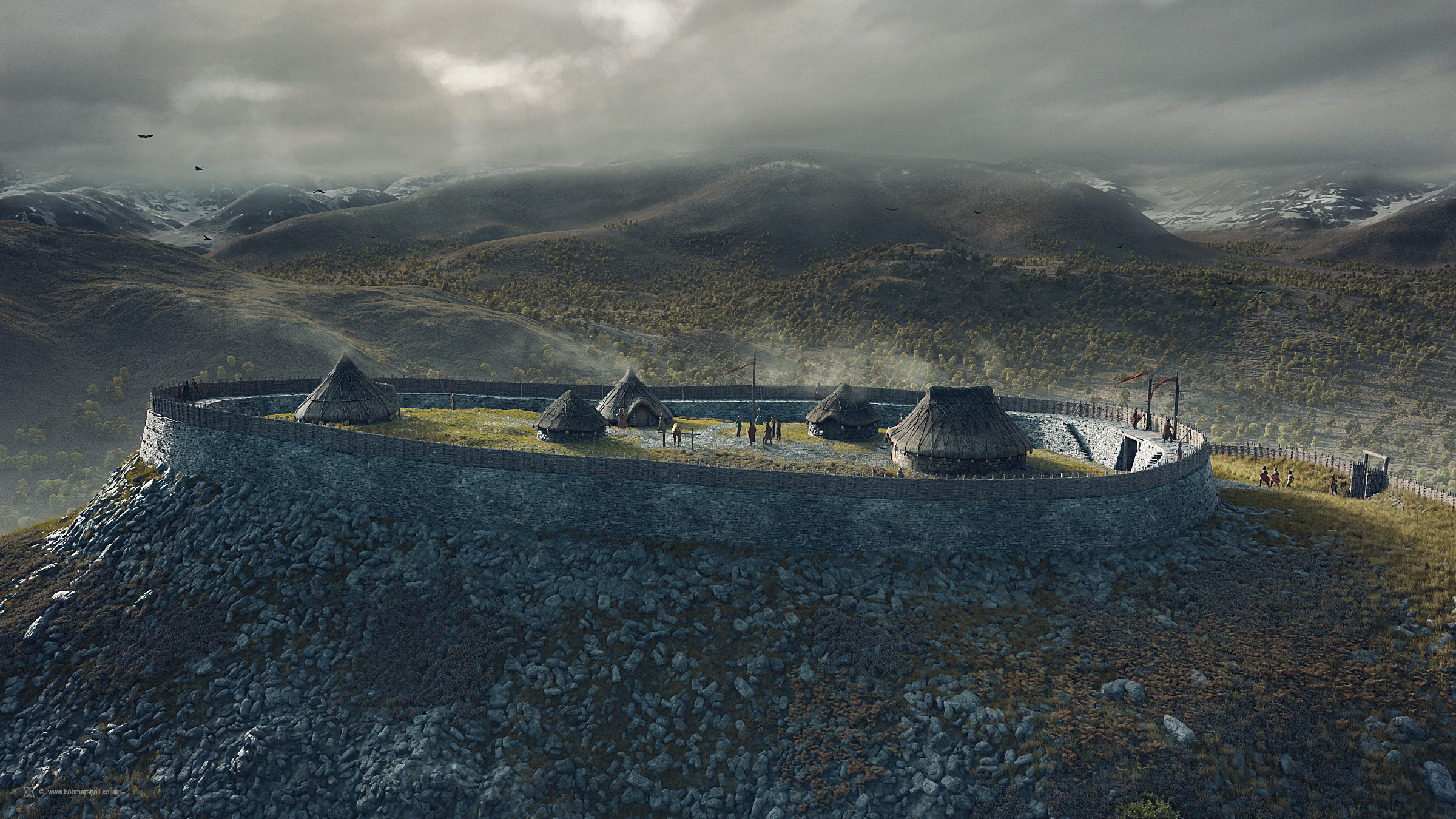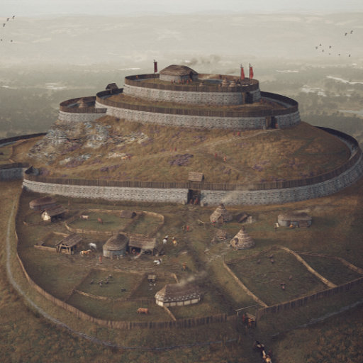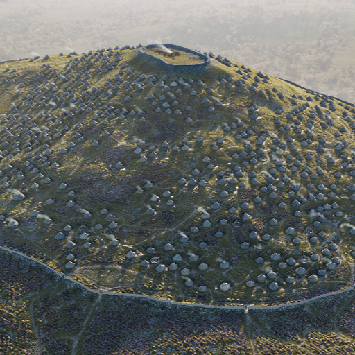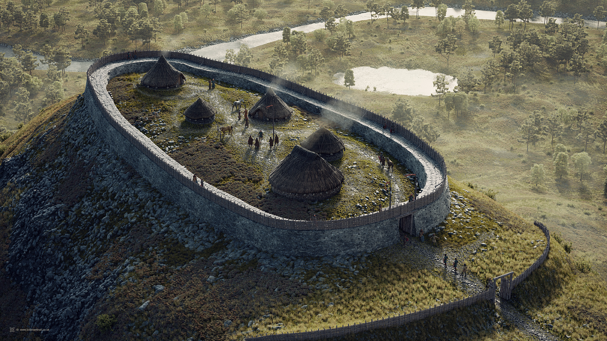
A speculative digital reconstruction of Tor Alvie hillfort near Aviemore, Scottish Highlands. The site was identified as a hillfort in 2010-11 (Historic Environment Record: MHG55341). Although the fort has never been excavated, the line of its rampart walls can broadly be determined by a stony bank that encloses an area of roughly 85m x 30m, bearing immediate similarities in size and shape to Craig Phadrig hillfort near Inverness. However, unlike Craig Phadrig, there is no evidence that Torr Alvie was vitrified. It is difficult to know how thick the ramparts were, whether there were timber palisades, and how many entrances the fort had, so imagination plays a large part in this visualisation.
How this image was made
Software and tools used: Blender 3D, Cycles Render Engine, Photoshop
Notes: The image was rendered from a digital 3D model (Blender). High-resolution digital terrain data was obtained from Ordnance Survey to create the landscape. The image was created with advice from Eve Boyle and Adam Welfare of Historic Environment Scotland, and from Professor Gordon Noble of the University of Aberdeen.
Commissioned Work
Artist:
Bob Marshall. November, 2020
Project consultants:
Eve Boyle, Gordon Noble
Client:
badenochstorylands.com / Cairngorms National Park Authority
Image rights owner:
© badenochstorylands.com / Cairngorms National Park Authority
Please seek the permission of the owner to use or display this image elsewhere.
My 3D models cannot be shared or licensed for other use due to contractual agreements with my clients and, in some cases, other stakeholders. More information can be found on my Licensing information page.